Sunday, June 19, 2016

Demographics

According to the 2011 Indian Census, the population of Indian Punjab is 27,704,236 (14,634,819 males and 13,069,417 females). The literacy rate is 75%, with male literacy being 80.23% and female literacy 68.36%.
  1. Ludhiana, population of 1,613,878
  2. Amritsar, population of 1,183,761
  3. Jalandhar, population of 873,725
  4. Patiala, population of 446,246
  5. Bathinda, population of 285,788
As of the 2011 census, the sex ratio of Punjab was 895 females per 1000 males. On account of female foeticide, Punjab has the second lowest sex ratio amongst all Indian states.
Being an agricultural state, a large part of the population lives in rural areas. Roughly 66% of the people live in rural areas while the other 34% are urban residents.
Punjab has the highest dalit population in India at 31.9%, including Scheduled Castes and Scheduled Tribes. Districts with high dalit populations are Ferozepur (42%), Nawanshahr (40%), Jalandhar and Muktsar (38%), Faridkot (36%), Tarn Taran (32%) and Kapurthala (30%). According to the Socio Economic and Caste Census 2011, Punjab has 36.74% scheduled caste households, which is the highest in India, but scheduled castes get only about 24% of reservations.
Punjab has highest percentage of landless households, about 45.34% of which are earning their income from manual casual labour.
Transport

Public transport in Punjab is provided by buses, auto rickshaws, Indian railways and an international rail connection to Pakistan (Samjhauta Express). The state has a large network of multimodal transportation systems.
Air
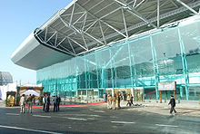
Punjab has six civil airports. The Sri Guru Ram Dass Jee International Airport in Amritsar and The Chandigarh International Airport inMohali are the two international airports of Punjab.
Other airports in Punjab are:
Rail
DMU Train in Ludhiana
Almost all the major as well as smaller cities of the state are linked by railways. Amritsar is the largest railway station, having trains connecting to all major cities. The Shatabdi Express connects Amritsar to Delhi. The railway junction in Bhatinda is the largest in Asia. TheShatabdi Express connects New Delhi to Bathinda.
Ludhiana Metro is a proposed rapid transit system for the metropolitan city of Ludhiana. The Samjhauta Express is a joint venture between Indian Railways and Pakistan Railways and runs from Attari railway station near Amritsar in India to Lahore Railway Station inPunjab, Pakistan.
Road
Punjab Roadways Bus
All the cities and towns of Punjab are connected by four-lane national highways. The Grand Trunk Road, also known as "NH1", connectsKolkata to Peshawar, passing through Jalandhar and Amritsar. Another major national highway connects Punjab to Jammu, passing through Hoshiarpur and Pathankot. National highways passing through the state are ranked the best in the country[by whom?] with widespread road networks that serve isolated towns as well as the border region. Ludhiana and Amritsar are among several Indian cities that have the highest accident rates in India.
There are also bus rapid transit systems like Amritsar BRTS and Ludhiana BRTS, in the cities of Amritsar and Ludhiana, respectively.
The following national highways connect major towns, cities and villages:

Economy

Burning of rice residues after harvest to quickly prepare the land forwheat planting, around Sangrur, Punjab
Punjab's GDP is ₹3.17 lakh crore (US$47 billion). Punjab is one of the most fertile regions in India. The region is ideal for wheat-growing.Rice, sugar cane, fruits and vegetables are also grown. Indian Punjab is called the "Granary of India" or "India's bread-basket". It produces 10.26% of India's cotton, 19.5% of India's wheat, and 11% of India's rice. The Firozpur and Fazilka Districts are the largest producers of wheat and rice in the state. In worldwide terms, Indian Punjab produces 2% of the world's cotton, 2% of its wheat and 1% of its rice. The largest cultivated crop is wheat. Other important crops are ricecottonsugarcanepearl milletmaizebarley and fruit. Rice and wheat are doublecropped in Punjab with rice stalks being burned off over millions of acres prior to the planting of wheat. This widespread practice is polluting and wasteful. In Punjab the consumption of fertiliser per hectare is 223.46 kg as compared to 90 kg nationally. The state has been awarded the National Productivity Award for agriculture extension services for ten years, from 1991–92 to 1998–99 and from 2001 to 2003–04. In recent years a drop in productivity has been observed, mainly due to falling fertility of the soil. This is believed to be due to excessive use of fertilisers and pesticides over the years. Another worry is the rapidly falling water table on which almost 90% of the agriculture depends; alarming drops have been witnessed in recent years. By some estimates, groundwater is falling by a meter or more per year.
According to the India State Hunger Index, Punjab has the lowest level of hunger in India.

Subdivisions

Districts of Punjab along with their headquarters, before 2007
The area of Punjab can be divided into:

Administrative subdivisions

The state of Punjab has 22 districts which comprise subdivisions, tehsils and blocks.
Divisions: There are 5 divisions in Punjab. These are PatialaRupnagarJalandharFaridkot and Firozepur.
Tehsils : 82 (in 2015)
Sub tehsils : 87
Maur is the latest tehsil, in the district of Bathinda. Zirakpur is the latest sub-tehsil, in the district of Mohali.
The state capital of Punjab is Chandigarh, a Union territory. It is shared with Haryana, being its state capital too. There are 22 cities and 157 towns in Indian Punjab. The major cities are LudhianaAmritsarJalandharPatialaBathinda, and SAS Nagar (Mohali).

Thursday, June 9, 2016

Government and politics

Each of the states of India possesses a parliamentary system of government, with a ceremonial state Governor, appointed by thePresident of India on the advice of the central government. The head of government is an indirectly elected Chief Minister who is vested with most of the executive powers. The state legislature, the Vidhan Sabha, is the unicameral Punjab Legislative Assembly, with 117 members elected from single-seat constituencies. The capital of Punjab is Chandigarh, which also serves as the capital of Haryana and is thus administered separately as a Union Territory of India. The judicial branch of the state government is provided by the Punjab and Haryana High Court in Chandigarh. The current Government was elected in the 2012 Assembly elections as the coalition of SAD and the BJP won 68 out of 117 Assemble seats and Prakash Singh Badal of the Shiromani Akali Dal is the current Chief Minister.
The state of Punjab is divided into five administrative divisions and twenty-two districts.

Animals and birds

A few of the rivers in Punjab have dangerous species of crocodiles. The extraction of silk from silkworms is another industry that flourishes in the state. Production of bee honey is done in some parts of Punjab. The southern plains are desert land; hence, camels can be seen. Buffaloes graze around the banks of rivers. The northeastern part is home to animals like horses. The desert area has dangerous species of snakes like the cobra and sangehur. Wildlife sanctuaries have many more species of wild animals like the otter, wild boar, wildcat, fruit bat, hog deer, flying fox, squirrel and mongoose.
Naturally-formed forests can be seen in the Shivalik ranges in the districts of Ropar, Gurdaspur and Hoshiarpur. Patiala is home to the Bir forest while the wetlands area in Punjab is home to the famous Mand forest.
Botanical gardens exist throughout Punjab. There is a zoological park and a tiger safari park, as well as three parks dedicated to deer.
The state bird is the baz (northern goshawk). (Melierax poliopterus), the state animal is the blackbuck (Antilope cervicapra), and the state tree is the shisham (Dalbergia sissoo).

Flora and Fauna

Agriculture in Punjab
The plains of Punjab do not have any thick forests. The only available flora are patches of grass, small bushes, and shrubs. In the southeastern part of Punjab and the areas of Gurdaspur, Hoshiarpur and Multan, mangoes are grown. Other varieties of fruit grown in abundance are orangesapplesfigsquincesalmondspomegranatespeachesmulberriesapricots and plums.
Major cultivation of rich flora and fauna can be seen in the Shivalik ranges. Due its rich flora and fauna, it has been termed a micro-endemic zone of India. There is a wide variety of angiosperms in the area, including 355 types of herbs, 70 types of trees, 70 types of shrubs of all sizes, 19 types of climbers, and 21 types of twines. Besides angiosperms, the region is home to 31 kinds of pteridophytesand 27 kinds of bryophytes, while a special species of gymnosperm named Pinus roxburghii can be seen in the ranges of Punjab.
The fauna of the area is rich, with 396 types of birds, 214 kinds of Lepidoptera, 55 varieties of fish, 20 types of reptiles, and 19 kinds of mammals. The state of Punjab has large wetland areas, bird sanctuaries that house numerous species of birds, and many zoological parks. Wetlands include the national wetland Hari-Ke-Pattan, the wetland of Kanjli, and the wetlands of Kapurthala Sutlej. Wildlife sanctuaries include the Harike in the district of Tarn Taran Sahib, the Zoological Park in Rupnagar, Chhatbir Bansar Garden in Sangrur, Aam Khas Bagh in Sirhind, Amritsar’s famous Ram Bagh, Shalimar Garden in Kapurthala, and the famous Baradari Garden in the city of Patiala.

Seasons

Punjab experiences three main seasons. They are:
  • Hot Season (mid-April to the end of June)
  • Rainy Season (early July to the end of September)
  • Cold Season (early December to the end of February).
Apart from these three, the state experiences transitional seasons like:
  • Pre-summer season (March to mid-April): This is the period of transition between winter and summer.
  • Post-monsoon season (September to end of November): This is the period of transition between monsoon and winter seasons.

Summer

Punjab starts experiencing mildly hot temperatures in February. However, the actual summer season commences in mid-April. The area experiences pressure variations during the summer months. The atmospheric pressure of the region remains around 987 millibar during February and it reaches 970 millibar in June.

Rainy season

The monsoon brings joy to the agricultural sector as farmers become very busy. Punjab's rainy season begins in first week of July as monsoon currents generated in the Bay of Bengal bring rain to the region.

Winter

Temperature variation is minimal in January. The mean night and day temperatures fall to 5 °C (41 °F) and 12 °C (54 °F), respectively. The winter season in northern Punjab is a blight for the poor who cannot arrange for protection against the cold.

Post-Monsoon transitional season

The monsoon begins to reduce by the second week of September. This brings a gradual change in climate and temperature. The time between October and November is the transitional period between monsoon and winter seasons. Weather during this period is generally fair and dry.

Post-Winter transitional season

The effects of winter diminish by the first week of March. The hot summer season commences in mid-April. This period is marked by occasional showers with hail storms and squalls which cause extensive damage to crops. The winds remain dry and warm during the last week of March, commencing the harvest period.

Rainfall

  • Monsoon Rainfall
Monsoon season provides most of the rainfall for the region. Punjab receives rainfall from the monsoon current of the Bay of Bengal. This monsoon current enters the state from the southeast in the first week of July.
  • Winter Rainfall
The winter season remains very cool with temperatures falling below freezing at some places. Winter also brings in some western disturbances.
Rainfall in the winter provides relief to the farmers as some of the winter crops in the region of Shivalik Hills are entirely dependent on this rainfall. As per meteorological statistics, the sub-Shivalik area receives more than 100 millimetres (3.9 in) of rainfall in the winter months.

Climate

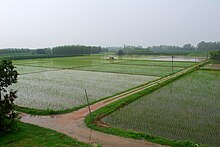
Agricultural fields of Punjab during the monsoon
The geography and subtropical latitudinal location of Punjab lead to large variations in temperature from month to month. Even though only limited regions experience temperatures below 0 °C (32 °F), ground frost is commonly found in the majority of Punjab during the winter season. The temperature rises gradually with high humidity and overcast skies. However, the rise in temperature is steep when the sky is clear and humidity is low.
The maximum temperatures usually occur in mid-May and June. The temperature remains above 40 °C (104 °F) in the entire region during this period. Ludhiana recorded the highest maximum temperature at 46.1 °C (115.0 °F) with Patiala and Amritsar recording 45.5 °C (113.9 °F). The maximum temperature during the summer in Ludhiana remains above 41 °C (106 °F) for a duration of one and a half months. These areas experience the lowest temperatures in January. The sun rays are oblique during these months and the cold winds control the temperature at daytime.
Punjab experiences its minimum temperature from December to February. The lowest temperature was recorded at Amritsar (0.2 °C (32.4 °F)) and Ludhiana stood second with 0.5 °C (32.9 °F). The minimum temperature of the region remains below 5 °C (41 °F) for almost two months during the winter season. The highest minimum temperature of these regions in June is more than the daytime maximum temperatures experienced in January and February. Ludhiana experiences minimum temperatures above 27 °C (81 °F) for more than two months. The annual average temperature in the entire state is approximately 21 °C (70 °F). Further, the mean monthly temperature range varies between 9 °C (48 °F) in July to approximately 18 °C (64 °F) in November.

Geography

Punjab is in northwestern India and has an area of 50,362 square kilometres (19,445 sq mi). It extends from the latitudes 29.30° North to 32.32° North and longitudes 73.55° East to 76.50° East. It is bounded on the west by Pakistan, on the north by Jammu and Kashmir, on the northeast by Himachal Pradesh and on the south by Haryana andRajasthan.
Most of the Punjab lies in a fertile, alluvial plain with many rivers and an extensive irrigation canal system. A belt of undulating hills extends along the northeastern part of the state at the foot of the Himalayas. Its average elevation is 300 metres (980 ft) above sea level, with a range from 180 metres (590 ft) in the southwest to more than 500 metres (1,600 ft) around the northeast border. The southwest of the state is semiarid, eventually merging into the Thar Desert. The Shiwalik Hills extend along the northeastern part of the state at the foot of the Himalayas.
The soil characteristics are influenced to a limited extent by the topography, vegetation and parent rock. The variation in soil profile characteristics are much more pronounced because of the regional climatic differences. Punjab is divided into three distinct regions on the basis of soil types: southwestern, central, and eastern.
Punjab falls under seismic zones II, III, and IV. Zone II is considered a low-damage risk zone; zone III is considered a moderate-damage risk zone; and zone IV is considered a high-damage risk zone.

Formation of current Punjab

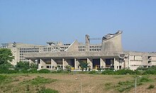
The capital city of the undivided Province of Punjab, Lahore, was allocated to the Pakistani West Punjab during the partition of British India in 1947, so a new capital for Indian Punjab was built at ChandigarhShimla was named temporary capital of the Punjab until Chandigarh was completed in 1960.
After years of protest by Akali Dal and other Sikh organisations, finally Punjab was divided on a linguistic basis in 1966. On 1 November 1966, the Hindi-speaking southern half of Punjab became a separate state, and Haryana and the Pahari-speaking hilly areas in the north became Himachal Pradesh. Chandigarh was on the border between Punjab and Haryana and became a union territory that serves as the capital of both Punjab and Haryana. During the 1970s, the Green Revolution brought increased economic prosperity for the Punjab, mainly due to the late Pratap Singh Kairon. However, a growing polarisation between the Indian National Congress central government and the main Sikh political party, the Shiromani Akali Dal, developed during the 1970s. Hostility and bitterness arose from what was widely seen by the Akali Dal as increasing alienation, centralisation and discriminatory attitudes towards Punjab by the Government of India. This prompted the Shiromani Akali Dal to pass the Anandpur Sahib Resolution, which asked for granting maximum autonomy to the region of Punjab and other states and limited role and powers of the Central Government.